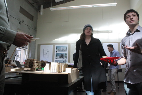
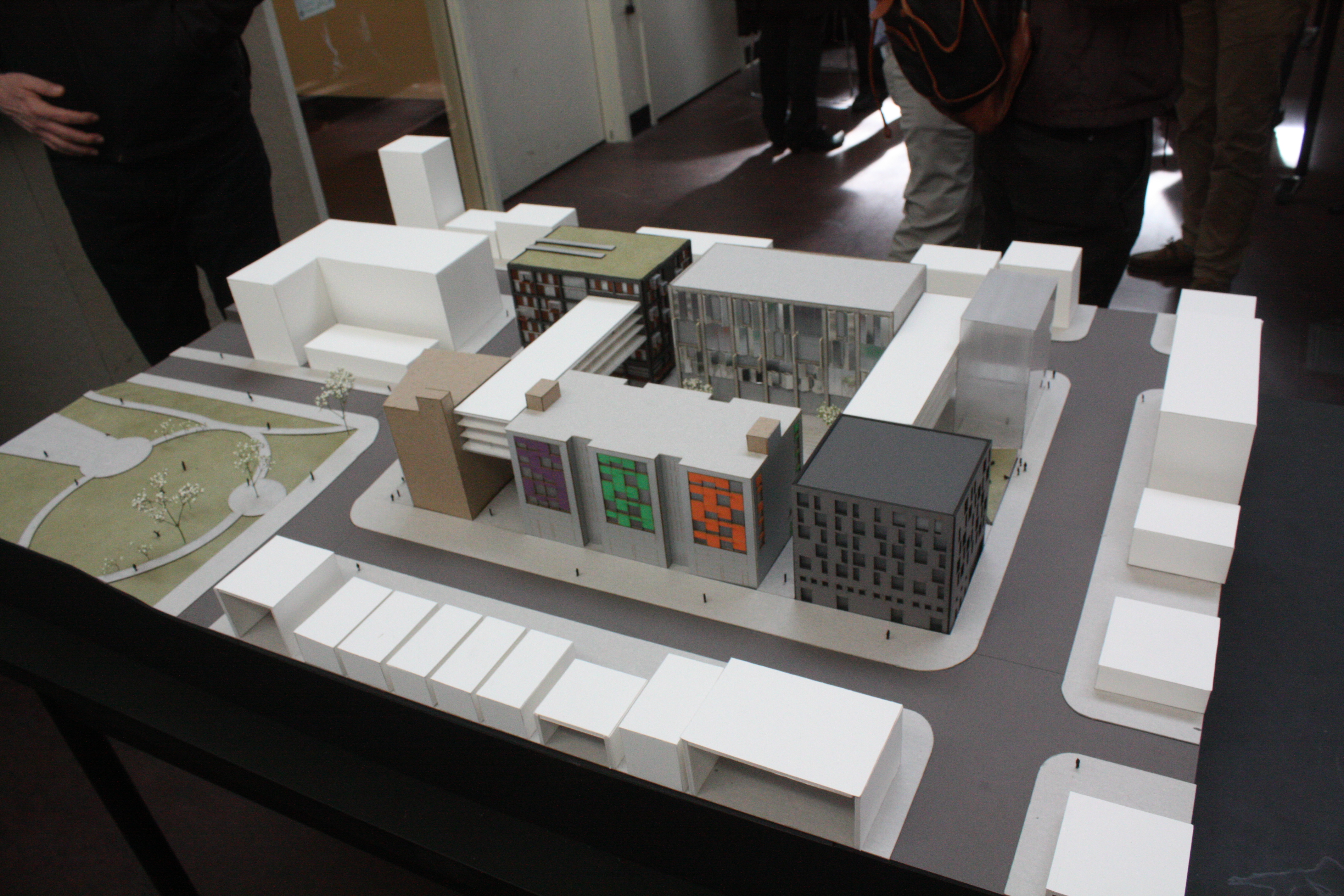
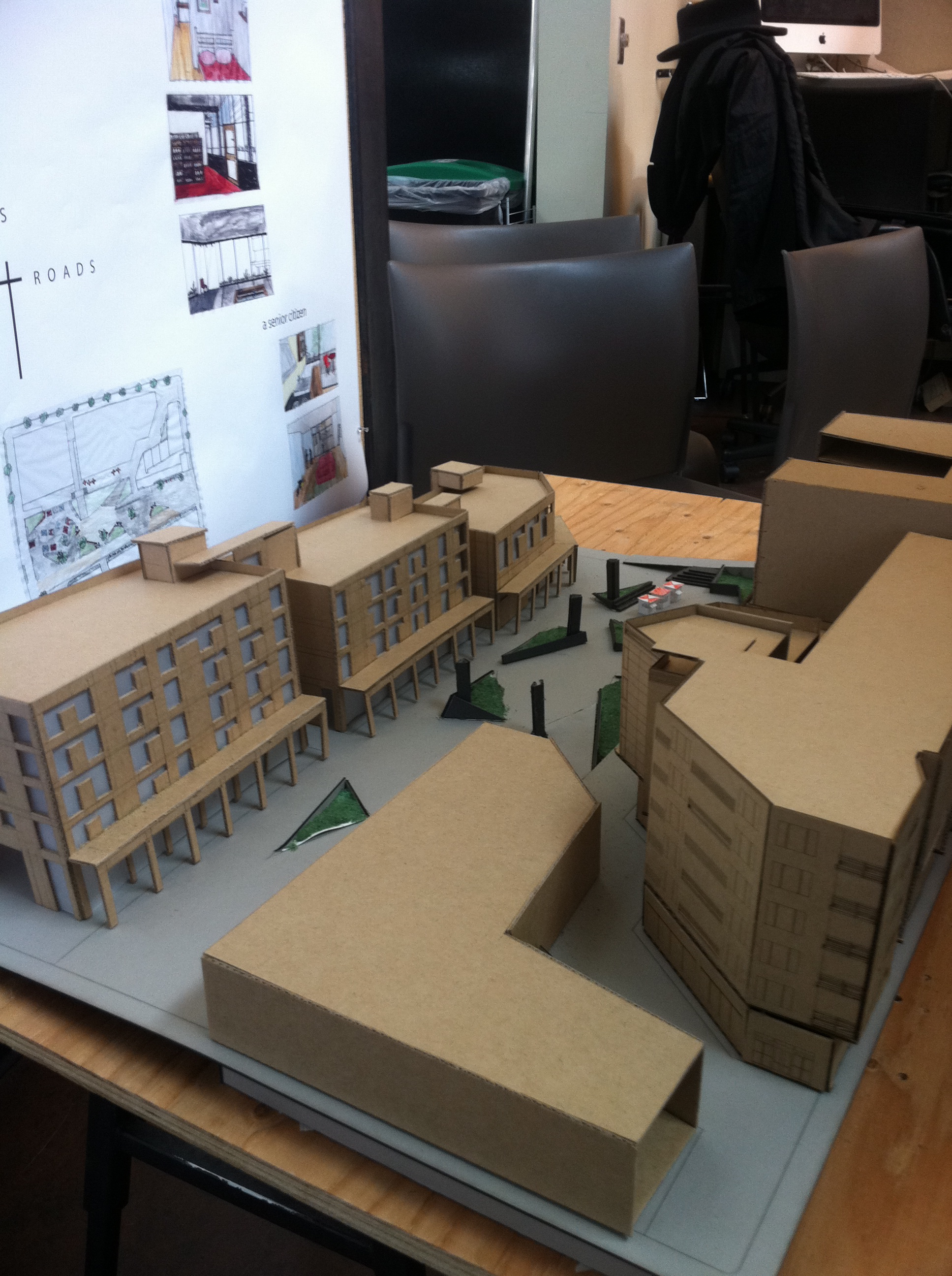
 The process to design the development project that will fill the land surrounding the Broadway light rail station when it opens for service in 2016 is still in its earliest stages — politics and big dreams. The politics part of the process doesn’t exactly print flyers and hold a lot of public events. But the big dream part did recently when teams of University of Washington architecture students shared their visions for Capitol Hill transit oriented development as part of a unique assignment melding academic design with a soon-to-be-realized project.
We’ve featured some images and two of the presentation documents from professor Sharon Sutton’s Undergraduate Architecture Studio Students, below. You might know Dr. Sutton as the outgoing chair of the Capitol Hill Design Review Board, by the way. Beyond simple inspiration for the possibilities of the space, the architectural exercise revealed some interesting takeaways about designing for the parcel that will stretch from Denny to John along Broadway and house a bustling light rail station beneath.
- All teams had to deal with a requirement for venting to provide the underground station and tunnels with fresh air. The wildest solution to this came from an open pit concept incorporated by one team who called their design The Station. “There would be signs,” a student explained regarding how people would be kept from plunging to their death in the 50-foot drop.
- For reasons including the need for central venting and the extension of Nagle, all designs created a north-south swath of open space through the middle of the station campus stretching from John to Cal Anderson.
- Teams were briefed on community goals for the space including space for affordable and market housing, retail and community space. The crowded milieu resulted in a couple of models that were extremely busy. “Was the different design for each component a conscious decision to surface the different use intended for each building?” CHS asked. “Not really. We didn’t meet as a group until we designed our pieces.”
- The process was also informed by takeaways shaped in last summer’s Sound Transit community meeting to discuss the extension of Nagle and “pedestrianization” of Denny.
- The Healthy Living concept, presented below, incorporated stalls for an open-air farmers market and a movie wall in a central plaza. There is a tentative plan to utilize space in the development for the farmers market. In the meantime, starting this May, the market will move to Seattle Central from its long-time home at 10th and Thomas.
- Nobody applied for any variances. All heights were kept to 6 stories and under.
 None of the concepts included the plot of land also owned by Sound Transit across the street from the Broadway station construction area that is currently used as Sound Transit offices north of Seattle Central. Sound Transit’s board recently approved a process to begin negotiating with the community college to sell the land to the school so that SCCC can develop the parcel as part of its campus.
- The process to produce a “request for proposals” for a developer to design the light rail station process is being banged out with a group representing the Capitol Hill Chamber of Commerce and community council in discussions with Sound Transit to shape the requirements. In the past, Sound Transit has said that the developer and architects won’t be officially selected until 2012 or 2013.
- The Capitol Hill Champion group is looking for an appropriate space on Broadway to display the student models from the exercise. We’ll let you know when a home is found.
- The Mt. Baker station development is one window into the future of process that will play out on Capitol Hill. Publicola reports on the four finalists for that development project here.
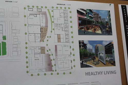
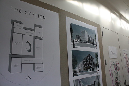
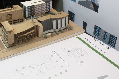
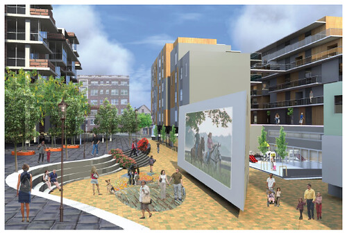


“The crowded milieu resulted in a couple of models that were extremely busy.”
It’s an entire block. It’s no busier than what it would replace. Broadway is not SLU and shouldn’t convert to a one-building-per-block form.
Thanks for posting these! It’s great to see some specific thinking about re-development of one of the blocks above the station. The students were focused on providing affordable housing, and they only looked at the one block from Denny to John. If we can find a storefront, the Champion will put them out for display on Broadway. We have recently completed a series of workshops led by the City to create an Urban Design Framework for the Sound Transit sites. A draft will be released to the public at the the beginning of May – the month of May will be for public comment, including a public open house on a Saturday morning – place and date TBA. The Urban Design Framework will guide Sound Transit’s Request for Qualifications process to select developers for the site
I think that artspace won the Mt Baker station RFQ/RFP.
Sky bridges are not pedestrian or community oriented. They remove pedestrians from street level atmosphere. Isolation is anti-urban. Please no buildings with sky bridges (apartments included).
Sky bridges look cool, but you’ve got a point there.
Yes, Artspace did win it and are moving forward. The link that jseattle gave is to a ULI ideas competition. Not related at all to the actual Sound Transit RFP.
The bridges in that design are actual filled with studio apartments. They’re not intended to get pedestrians off the plaza, but to increase the density and give the plaza more of a square, feeling, instead of linear.
These particular sky bridges are designed as single room occupancy for transitional homeless housing – giving the recently housed great south light in which to feel more human! Generally, don’t like sky bridges such as the one at the Convention Center – However, this block will have a huge open space in the middle of it due to Sound Transit’s desire not to build on top of the station box. This space requires a high level of activation to be successful. So consider some possibilities such as cantilevers/sky bridge housing/canopies/arcades as ways to provide sheltered open space on rainy days… Also consider sky bridges and cantilevers as ways of increasing the residential density/developable square footage on the sites so we can increase the community benefits -such as affordable housing and civic/cultural space and affordable retail, – and as means to more interesting architecture
I assume they put in the skybridges because they can’t build on top of the station “box” (as ST calls it), where Nagle Place/farmer’s market is planned. I actually thought it was an interesting way to make up for the lost development opportunity there. But yeah, in general, I’m not a big skybridge fan either.
The Joule has space, or how about the mezzanine at the Broadway Market, that way we can see all sides of the models.
Great to see some ideas, but no comment in the text about the STATION itself, where it is, how one gets into it. Is not the station as designed a fixed element? If so, should not these designs reflect the reality of the station (which in my opinion is poorly planned, or designed with no hint of future context). I think using air rights to include bridging elements is a great idea used in moderation. One of the requests for a outdoor market is that it be covered—maybe a bridging element could give that protection.
There is a shopping mall in Scottsdale,AZ that has a retractable glass roof over much of the common space. Something like this would be an interesting idea to explore for the market space, and make the space more usable more days of the year.
I attended many of the community meetings/charettes and I can see where some of the students have listened/done their homework and included a few of the desired design and programming features discussed by the community- a process often ignored by contemporary design professionals. Very nice work and at a high level of output for undergraduate students. Good job!
…wish I could say the same for STrans who chose to take the above ground design of the stations to completion before developing schematics for the remaining TOD. oy, way to be a “sore thumb”…
Some sort of glass roof would be cool, especially since the plaza will get southern sun exposure. So the roof could provide rain protection without blocking a lot of direct sunlight.
The single most important issue to be addressed in this redesign is how to convince ST/Seattle pundits that the half block of Denny running through the ST site should be permanently closed to car traffic. Doing that would open up many more possibilities for the space, and keep away the stream of extra cars through Denny that will pile up to avoid the intersection of B’way and E. John; this feature would also promote pedestrian safety during the influx of walkers to the park after every link train empties out. But good luck getting people to eliminate even one half block of road!
I agree with the point made about sky bridges. They really remove the density from the streets where you need it. However, I don’t think that is the case here.
I do like the idea of enclosing the plaza. I’m not sure that I like the idea of studio apartments bridging the gap. And is that legal? I know Steven Holl does this in China, but he adds a pool! My point: either find a different way to enclose the plaza (an iconic building at either side of the plaza could have the same effect) or go all out!! Studio apartments just sounds like a quick excuse. You should have a community center, single family condos, or a sports center with a climbing wall. Make your gestures large and meaningful. We’ll let you know when it’s too much.
Good luck!
—
Seattle Architects Coates Design specializes in green building and sustainable design.
These architectural styles are already so dated and really neglect the public realm. More poor modernist designs. Sigh.
I think given the overwhelming neighborhood desire for it, after six years of closure getting all or most of the cars off that block of Denny will be very easy. It’s just a street vacation, and SDOT is developing “festival street” regs now that would probably apply there.
Dated? What would you prefer? If it neglects you must clearly say how it does so.